Blog
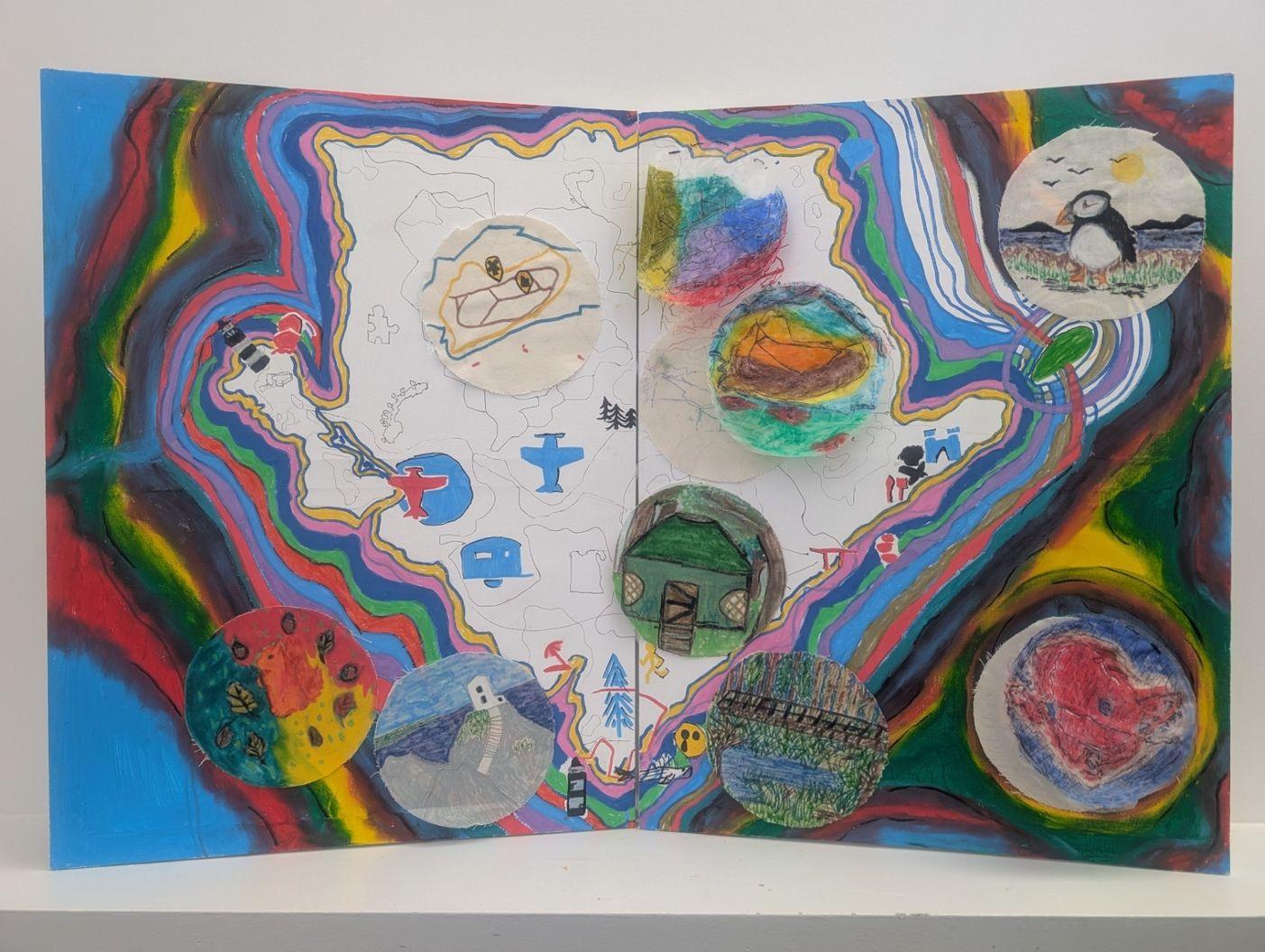
Empowering Home Edders to have their say and become mappers
Home Edders become mappers is a project that empowers young people who are home educated to have their say about where they live by becoming Mappers themselves. In this blog, Kim Hutchinson, a Community Mapper on Public Map, explores how by delivering a series of free digital mapping workshops with young Home Edders, they are able to record their individual and collective experiences of Ynys Môn through visual art.


Mapping Rivers on Ynys Môn
A glimpse into how creative community mapping on Ynys Môn is helping people — especially young people — reconnect with rivers, place, and each other, this blog shows how seeing landscapes as living entities can reveal hidden stories, spark care, and plant the seeds of a wellbeing-led future.


Note from the Room - Opening
Since opening its doors in February, the Wrexham Room has been going from strength to strength and building connections with communities from across the city.


Reflections on Community Mapping: from participation to Impact
Over the past two years at Public Map, I have explored how digital mapping can empower communities, capture local knowledge, and support decision making across schools, councils, and policy settings. Through diverse projects including storytelling, environmental mapping, and creative and educational initiatives, I have developed skills in engagement, facilitation, and spatial analysis while reflecting on how maps can influence understanding and action.


Mapping the Green Transition: why story is the missing link
What if the real key to unlocking the green transition isn’t more data or policy - but the stories we tell, and who gets to tell them?


Katrina Moinet: Writing Place, Language, and Belonging on Ynys Môn
This blog explores poet Katrina Moinet’s relationship with Ynys Môn as a living, shaping force in her writing. Through reflections on landscape, bilingualism, poverty, feminism and community, Katrina speaks about how place, language and belonging are deeply intertwined in her work. The piece traces how experiences of hiraeth, being othered through language, and growing up in economic hardship inform her poetry, alongside her responses to activism, gendered safety, and collective ritual. It also situates her within a wider Welsh poetry scene that connects writing with land, protest and care for place. Ultimately, the blog presents Katrina’s practice as one rooted in attention, lived experience and community, showing how poetry can actively participate in the protection, memory and meaning of landscape.

Social Mapping – Integrating social mapping in teaching and learning
In this blog, Matluba Khan and Tom Smith share how we’re building a set of educational and learning resources, mapped to the Curriculum for Wales, to enable anyone to pick up and use them as learning tools and in so doing, also help to create a social map layer on Public Map.


Social Mapping – how we use places socially and how to map them
How do we use places socially and how do we map them? Place makes a difference to how we act socially. One of the core purposes of Public Map is map social places – to help us better understand the places that local children, young people, and adults, value as social spaces, and where they feel social space needs to be improved. In this blog, Matluba Khan and Tom Smith introduce the social mapping work they’re leading.

The Growing Role of Welsh in Lle Llais
From its beginnings in 2024 to a stronger return in 2025, Lle Llais has shown how Welsh can move from the sidelines to the heart of community events on Ynys Môn. This post explores how the project is helping the language flourish — and why its story matters for the future of Cymraeg


Public Map: helping to realise a Wellbeing Economy
In this blog, Rachel explores how Public Map speaks to a Wellbeing Economy agenda and is a tangible tool and set of practices that contribute to shifting our economic system.


Exciting plans afoot: phase 2 of Public Map
Thanks to the Arts and Humanities Research Council, Public Map has been awarded a further £3.1m to continue our work over the next 2 ½ years. In this blog, Professor Flora Samuel shares the exciting plans and areas of focus during phase 2.


Biodiversity and the Welsh language
Inspired by a Social Mapping walk with a class of primary school children, Community Mapper, Ben Jones reflects on the richness of the Welsh language for describing the natural world and what could be lost if we don't preserve biodiversity.


Making maps move: Reflections on Lle Llais animation workshops
How can we invite children’s creativity into mapping, using movement and animation to make our maps feel alive? Nia reflects on children’s thoughtful, surprising, and vibrant animations made during Lle Llais workshops, and how they can communicate with other children in a unique way.
