
The people, institutions and funders behind Public Map
Public Map is a research-led platform born from a national programme to put design at the heart of the UK's green transition. Our work is funded by the Arts and Humanities Research Council (AHRC), part of UK Research and Innovation (UKRI), and delivered as one of four Green Transition Ecosystems within Future Observatory: Design the Green Transition — the Design Museum's national research programme for the green transition, and the largest publicly funded design research and innovation programme in the UK.
Funded by
In partnership with
Our funder
Public Map is funded by the Arts and Humanities Research Council (AHRC), part of UK Research and Innovation (UKRI) — the UK's largest public funder of research and innovation. AHRC funds world-class research across the arts and humanities, from history and archaeology to design, digital content and the impact of artificial intelligence. AHRC has placed design at the heart of its strategy for collaboration within UKRI.
UKRI's "Building a Green Future" strategic theme accelerates the UK's transition to a secure and prosperous green economy. Public Map sits within that portfolio.
Future Observatory: Design the Green Transition


Future Observatory is the Design Museum's national research programme for the green transition, in collaboration with the UKRI Arts and Humanities Research Council. Launched in November 2021 to coincide with COP26, Future Observatory curates exhibitions, programmes events, funds and publishes new research, all with the aim of championing new design thinking on environmental issues.
Future Observatory: Design the Green Transition is a multi-million-pound investment funded by AHRC and delivered in partnership with the Design Museum. It is the largest publicly funded design research and innovation programme in the UK, benefiting more than 100 higher education institutions and 75 industry and local authority partners across the nation. Public Map is part of its flagship funding strand: the Green Transition Ecosystems.
The Design Museum, located in Kensington, London, is the UK's national museum of design. Founded in 1989 by Sir Terence Conran, the museum was awarded European Museum of the Year in 2018. Future Observatory is hosted there and acts as both a coordination hub for the nationwide programme and a research department within the museum.
“Design is a critical bridge between research and innovation… that's why AHRC has placed design at the heart of its strategy for collaboration within UKRI.”
“We are delighted to be supporting and collaborating with these four centres of research excellence, on themes ranging from housing and waste to sustainability across the NHS.”
See us on display
Future Observatory: Tools for Transition
Free entry · Level 2, Design Museum · 12 September 2025 – August 2026
The Green Transition Ecosystems cohort
Public Map is one of four Green Transition Ecosystems (GTEs) — large-scale, design-led research projects funded by AHRC and coordinated by Future Observatory at the Design Museum. Each GTE addresses a distinct challenge of the green transition through a regional cluster of universities, industry, public bodies and communities. We're proud to share this cohort with three exceptional projects:

Design HOPES
Healthy Organisations in a Place-based Ecosystem, Scotland
Design HOPES is a transdisciplinary research initiative led by the University of Strathclyde and the University of Dundee, with Heriot-Watt, Abertay and the University of Edinburgh, working with NHS Scotland boards, the Scottish Government, V&A Dundee and design partners to embed design-led innovation in healthcare. Outputs include circular waste systems, reusable theatre clothing and the Green Ward Toolkit.
Led by
Prof Paul Rodgers (Strathclyde) and Prof Mel Woods (Dundee)

Future Island-Island
Shaping a greener future through design, with Rathlin Island as a lens.
Led by Ulster University with Queen's University Belfast, the Glasgow School of Art and University of the Arts London, plus partners including National Museums NI and RSPB. Working through five workstreams centred on Rathlin — Northern Ireland's only populated offshore island — to develop scalable models for other rural and coastal communities.
Led by
Prof Justin Magee (Ulster) and Dr Clare Mulholland (Queen's University Belfast)

Transforming Housing and Homes for Future Generations
Beyond Net Zero liveable homes, co-designed with communities.
A GW4 Alliance project — Bath, Cardiff, Bristol and Exeter universities — working with residents, local authorities and industry in Knowle West (Bristol) and Townhill (Swansea) to co-design, test and monitor low-carbon retrofit solutions for the 1.1 million UK homes built between 1920 and 1940.
Led by
Prof Pete Walker (Bath) and Prof Jo Patterson (Cardiff)

Public Map Platform
A bilingual community mapping platform, charting the green transition.
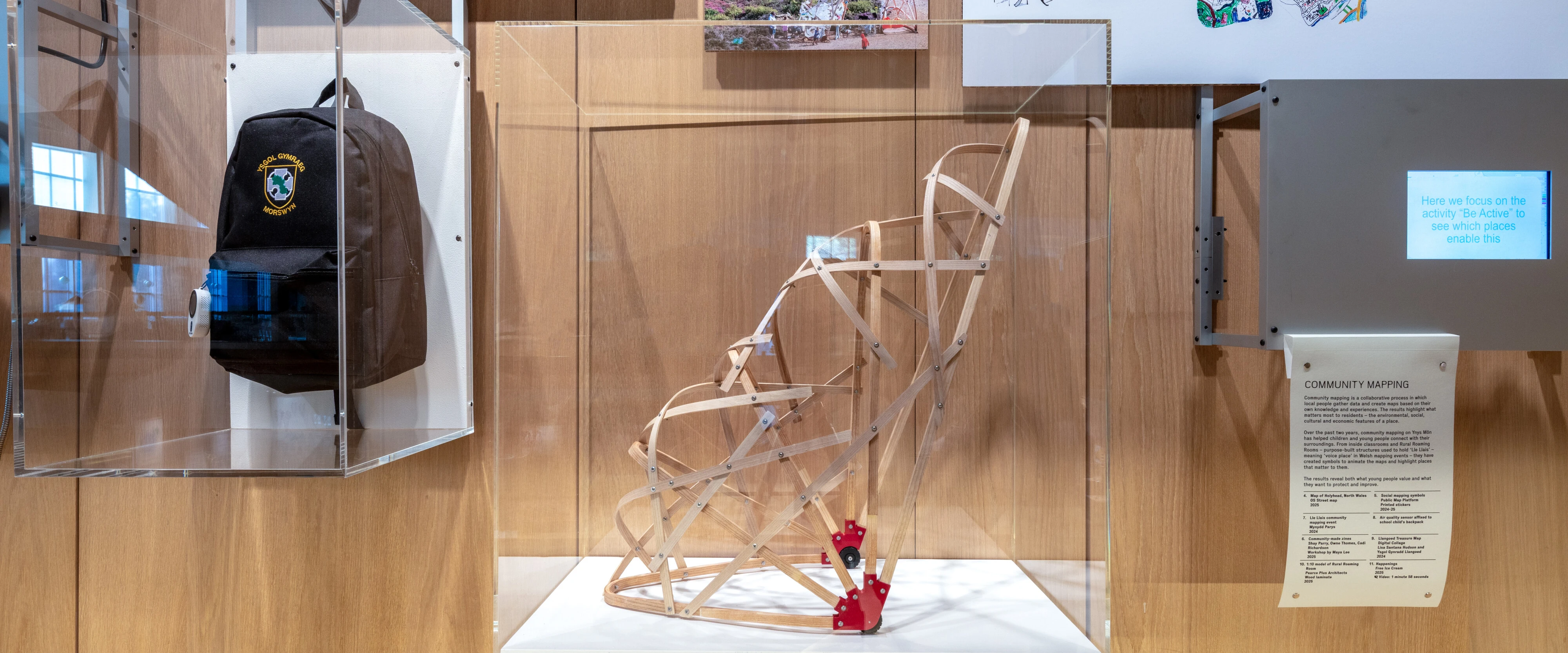
Spatialising social, environmental, cultural and community data so people, planners and local authorities can make better decisions together. Originating on Anglesey / Ynys Môn and expanding nationally.
Led by
Prof Flora Samuel (Cambridge), with Prof Scott Orford (Cardiff/WISERD) and Prof Alec Shepley (Wrexham)
Together, these projects show how scalable, design-led research can be translated into practical tools for transitioning to a greener future.
Our research consortium
Public Map began as a research collaboration between the University of Cambridge, Cardiff University (through the Wales Institute of Social and Economic Research and Data — WISERD), Wrexham University and Bangor University, exploring how planning could become fairer, more inclusive and better informed through mapped data. The platform is led by Principal Investigator Professor Flora Samuel (Department of Architecture, University of Cambridge), with Professor Scott Orford (School of Geography and Planning, Cardiff) and Professor Alec Shepley (Wrexham University) as Co-Investigators.


Prof. Flora Samuel
Head of Architecture Department
University of Cambridge

Prof. Scott Orford
School of Geography and Planning
Cardiff University / WISERD

Prof. Alec Shepley
Associate Dean for Research & Professor of Arts and Society
Wrexham University
Wider partners and supporters
Around our research consortium, Public Map is shaped by a much wider community of partners — local authorities, statutory bodies, community organisations, schools and individual mappers — without whom this work would not exist.
Government & statutory partners
Academic & training partners
Community, cultural & education partners
Cohort & programme
This list reflects our collaborators at the time of writing — Public Map's network grows continually. To partner with us, please contact post@publicmap.org.
Public Map logos
Download the Public Map logo pack for use in partner materials, presentations and press.
Download logos →