Research Projects
Mapper-led projects exploring how Public Map can be used to move towards a greener future.
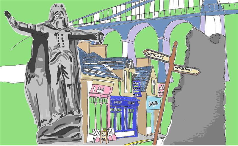
Green Street
This project explores how local Highstreets can thrive through circular economy principles, working with businesses, schools, and communities to reduce waste, share resources, and create greener, more inclusive spaces. This project focuses on two locations, Porthaethwy, Ynys Môn and Llantrisant, Rhondda Cynon Taf, promoting shared learning between North & South Wales and an exchange of ideas, resources, and case studies between two distinct but comparable communities. The method will be community led, starting with a High Street Health Check, mapping what is already there and identifying gaps, then moving into designing and delivering collaborative workshops that will bring together different groups of people, using the Public Map to document the process and developments. The aim is to produce a circular economy map as a basis for a community and business owner-led circular economy action plan, a commitment to some behavioral changes and a continuing dialogue between Llantrisant and Porthaethwy.
Green Tracks
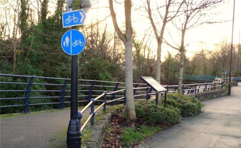
This project aims to explore people’s experience of green and active travel on Ynys Môn, supporting the Welsh Government’s goal of addressing climate change while improving health and well-being. We have chosen to focus on cycling, with some attention on other forms of sustainable travel. We will create cycling maps aimed at helping parents and children to cycle routes which are safe and fun. We hope these will encourage families to enjoy Anglesey by bike, as they will showcase special landscape features and handy amenities. We also plan to run mapping workshops with groups from a variety of different demographics in which participants use the Public Map to map their routes. Running the project over a full year will enable us to investigate how green and active travel experiences vary seasonally. Ultimately, the project will build community mapping skills, promote the Public Map, and encourage wider uptake of active, sustainable travel, thereby promoting green transition behaviours.
Historical Mapping
Using a variety of historical sources, we will create a multi-layer map of past land use in south-western Môn at a time when the island was largely self sufficient. This will enable various communities on the island to engage critically with how land was used in the past, and think about how land might be used more sustainably in the future building on Welsh language and culture. Looking to the medieval and early modern periods, Ynys Môn was an island of mixed farming with a much larger proportion of arable land than at present. We will show how use has changed, for economic reasons, because of patterns of landholding, as well as environmental changes such as the spread of sand dunes. We will use this long-span understanding of how land can be used to inform and question communities about the possibilities of sustainable farming, alternative land use, and how we can shape and respond to climate change. Participants will have the opportunity to record their memories or knowledge of how the land was used or farmed on the map and to consider how things have changed and why.
Landscape Memory
in partnership with Natural Resources Wales
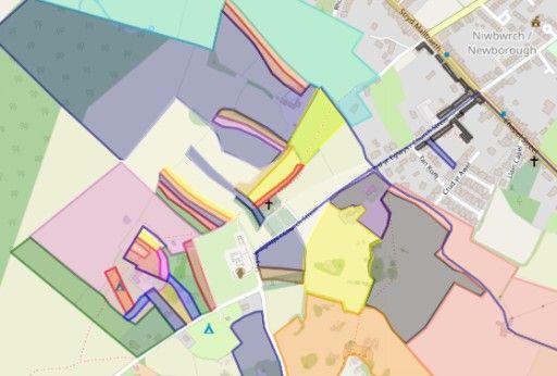
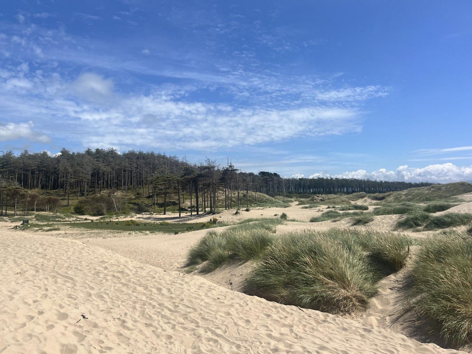
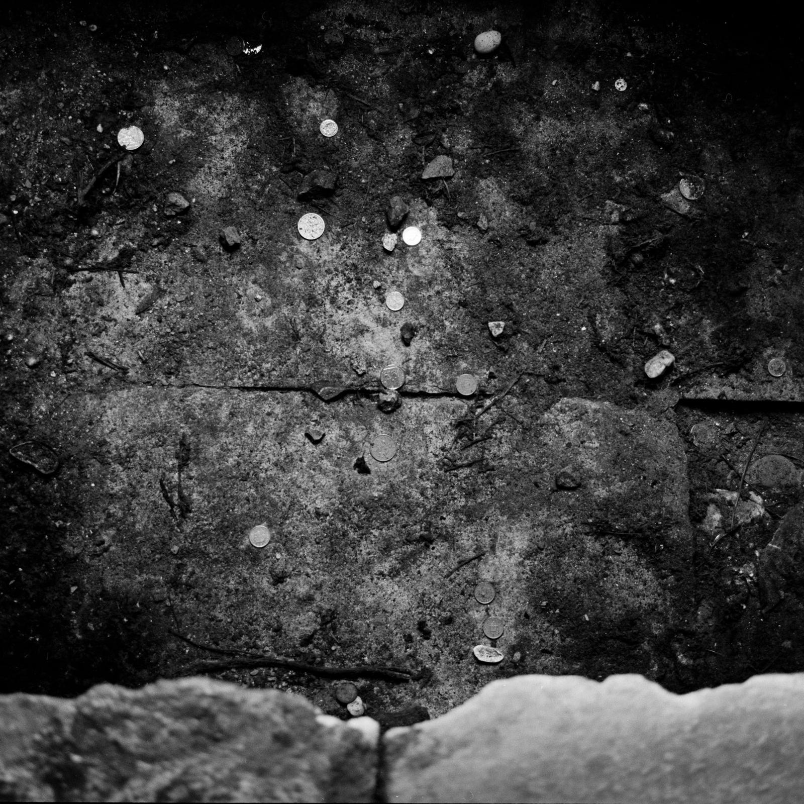
Landscape Memory is a collaboration between the Public Map, Natural Resources Wales and the community of Niwbwrch with the aim of mapping the impact of climate change on a landscape that faces significant environmental changes in the future. The project will be centred around mapping and rediscovering homes, farms and industrial buildings that have been taken over by natural vegetation and sand dunes over the centuries. Two maps will be made, the first showing the landscape that has been lost and the second showing the landscape as it is now. The maps will include stories, memories and various kinds of multimedia content. Tir Forgan the lost home of the last professional crwth player will form a focus for the discussion. Intergenerational exchange will be encouraged through the collecting of data, with the mapping process fostering discussions of environmental change. An info board at the site encourage visitors to engage with the map.
The Almanac of Echoes
in partnership with Cadw
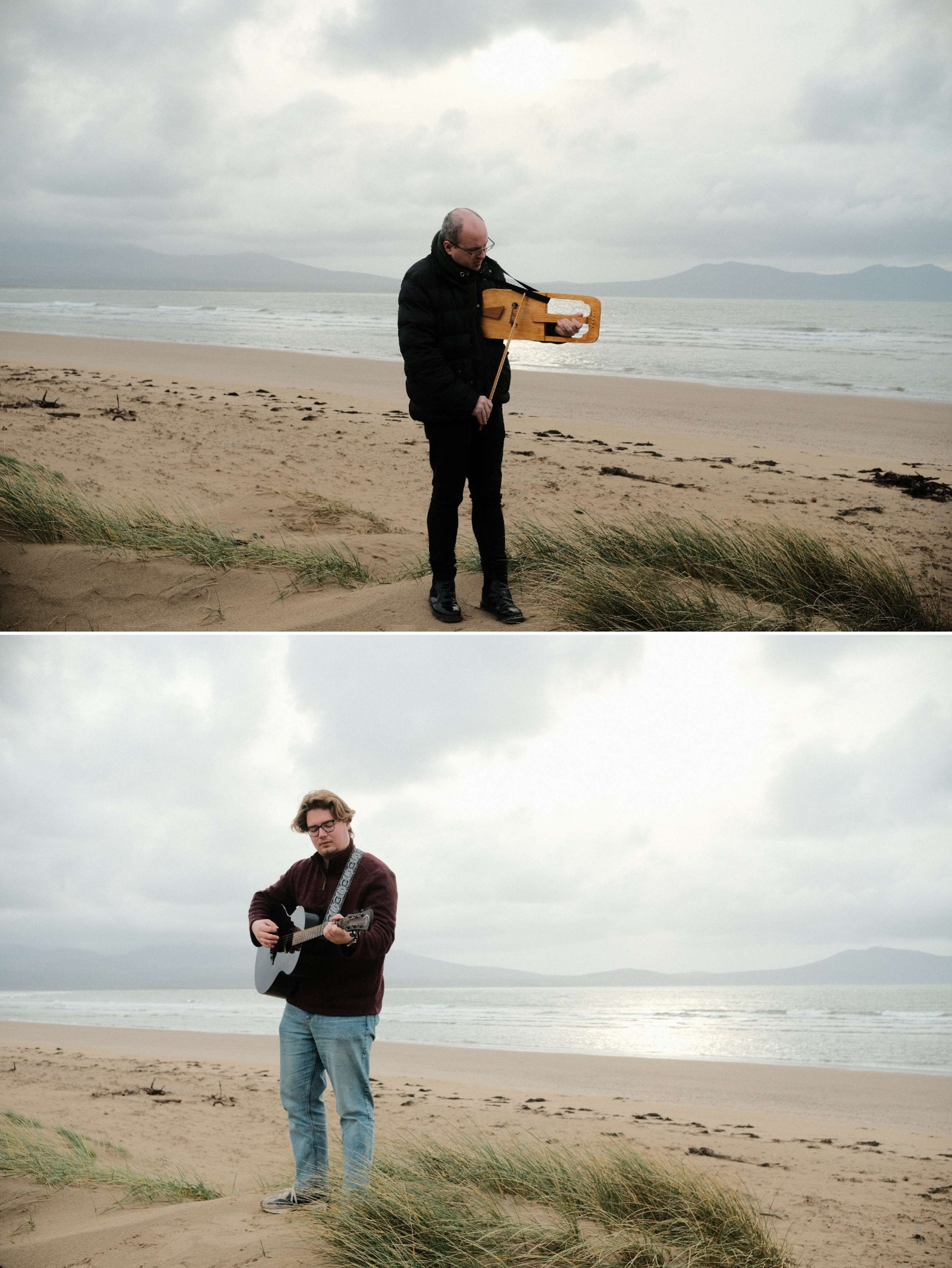
"The story of cyclical time on Ynys Môn" An Almanac is a publication that can help us to structure our life over the year. This could mean recording the lunar cycle or a seasonal ritual that celebrates the way humans interact with the land, sea and sky. We aim to record the voice of place, its people and environment for past, present and future generations by creating an interactive Almanac. The publication will invite both the community and visitors to chart their experience of special, historical, and sacred places on the island, including those with mythic and folkloric associations. Our practice will involve uncovering and mapping a range of sites on Ynys Mon through photography, performance and word to echo the traditional and the new, forming a call to action for users of the Almanac. Sections will include opportunities for creative reflection – such as drawing, embodying, and creative writing; inviting readers to document their own individual journey. Data from the almanac will be form a layer on the Public Map of Ynys Môn enabling people to connect to special places and moments in the islands cultural year. Image: Fynnon St Seiriol, Penmon, ynys Mon ©janetruthdavies
Sounds of Place
in partnership with Barnardos
This project, led by Joe and Tristian, aims to inspire participants to explore environmental and wellbeing themes through music. We will guide them in writing and composing their own songs that reflect the natural world, local issues, and the importance of caring for the planet. Through interactive activities, we will introduce simple songwriting techniques, rhythm-building exercises, and creative prompts that encourage participants to express their ideas in a fun and engaging way. By the end of the workshop, each group will have created an original piece that showcases their understanding of environmental stewardship. Our goal is to empower people to use music as a tool for awareness, expression, and positive action within their communities. Outcomes of the project include a Teaching Pack materials to inspire teachers to work in this way as well as a map linking musical outcomes of the project to places.
Cefni Connections
in partnership with Caru Cefni & A Grand Week in Wales
This project celebrates the rich connections between local communities and the Afon Cefni, from source to sea. Through storytelling, creative workshops, and public mapping, people of all ages are invited to share memories, observations, and everyday experiences of the river — recognising it as a vital part of local life, history, and identity. By bringing together personal stories and place-based knowledge, the project encourages intergenerational conversations and challenges “shifting baseline syndrome,” where gradual environmental change becomes accepted as normal. Public mapping also helps identify pollution hotspots and opportunities for collective care, supporting practical action such as targeted litter-picking and river restoration. Inspired by the Rights of Rivers movement, the project invites participants to imagine the Afon Cefni as a living entity and to explore what it means to care for the river together, now and for future generations. Outcomes of the project include Teaching Pack materials to inspire teachers to work in this area as well as a detailed map of the river recording the process.
Mapper Award Scheme
in partnership with Holyhead High School
The programme aims to build a strong community of young mappers by establishing a network of skilled Mapping Ambassadors in schools. These ambassadors will strengthen student voices, promote green transitions in education, and use digital mapping to support positive social, environmental, cultural, and educational change. Participants will work towards Mapper Awards at four levels. These are achieved by meeting the set criteria for each level. The process encourages peer learning, builds digital skills, and supports behaviours aligned with green transition goals. At the heart of the programme is the Mapping Ambassador initiative, designed to inspire young people to use their lived experiences and voices to shape their communities. Through a series of hands-on workshops, selected students will be trained to use digital mapping tools such as OpenStreetMap (OSM), uMap, StreetComplete, and KoBo. Learners will map their own and their peers’ experiences, creating their own original digital maps. Once a participant has completed all four levels they become a 'Mapping Ambassador' will share skills and collaborate with other Mapping Ambassadors, creating a connected platform for student voice and future change. Outcomes of the project include a map of Ambassadors as well as Teaching Pack guidance for those wanting to encourage mapping in their schools.